Michigan first-responders train on safe, effective use of drone technology at Mcity Test Facility
Two-day training, in realistic scenarios at the Mcity Test Facility, provides certification credits and helps communities plan for drone use in emergencies
ANN ARBOR—Public safety officials and first responders came to Mcity and University of Michigan Engineering last month to learn how to use drone technology effectively and safely in the first training program of its kind in the state, conducted in partnership with the Michigan Drone Association.
Aerial drones give police, fire and rescue, and municipal officials a revolutionary tool for their work—putting eyes on the scene of an incident faster than ever, helping with search and rescue scenarios, and providing real-time information to decision-makers. And drones equipped with infrared and thermal cameras allow operators to see more than the human eye.
“We’re trying to help these public safety departments establish their policies and procedures for drone use,” said James Lollar, Mcity’s test facilities manager. “Like the military, first responders are just dipping their toe into utilization. And the first question is ‘How can we most effectively use these new tools?'”
The training is one of the first examples of how Mcity, part of the U-M Transportation Research Institute, expanded its scope as a public-private mobility partnership from the ground to the sky with last summer’s launch of M-air.
As with many new technologies that find wider use, there are no established standards for how drones are employed. While first responders learn by doing, best practices are hard to establish when teams face these situations infrequently, and training exercises are all but impossible. For instance, an overturned semi on a busy highway doesn’t happen every day, and staging such an event on an active roadway would be impractical.
However, U-M has just the place for practice sessions. The Mcity Test Facility, designed as a proving ground for connected and automated vehicles, offers many relevant locations, including a simulated downtown area with urban streets and a 1,000-foot straightaway with access ramps.
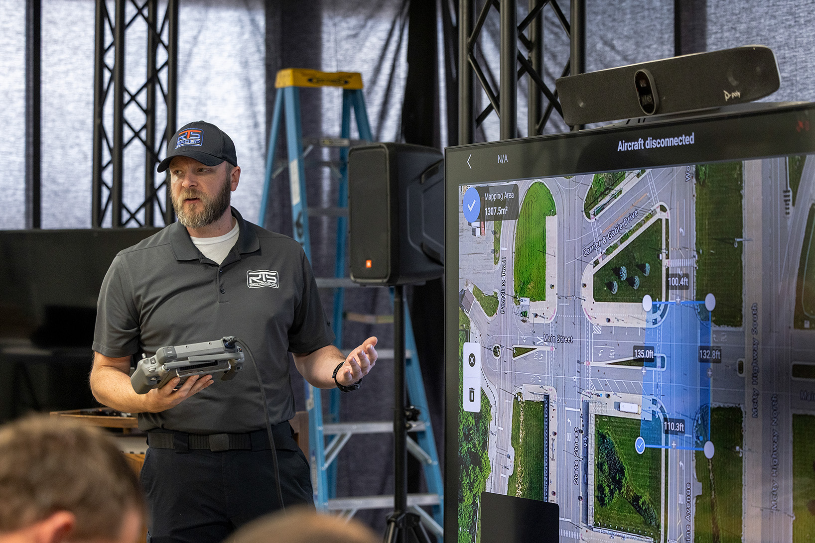
Over two days in February, Mcity hosted more than 20 officials from ten different law enforcement agencies around Michigan, as well as one from Nebraska. Information sessions included: photogrammetry (using 2D photos to create 3D models), equipment considerations and methods of data capture. Using Mcity’s simulated environments, attendees worked with two different scenarios. The first simulated a highway accident, while the second reproduced a crash at a four-way intersection. Participants used drones to capture the data they needed to map and model reconstructions of the mock crash scenes. Such reconstructions could even be used during a trial if necessary.
Drones are applicable for law enforcement uses beyond crash investigations, such as search and rescue, and overseeing acres of land, such as a park.
“Implementing drone-based mapping enhances the Huron-Clinton Metroparks Police Department’s ability to document incidents, plan operations, and manage large park areas with greater accuracy and efficiency,” said Sgt. Chris Proudlock. “By training and collaborating with partner agencies in a simulated environment, our team can build real-world skills while learning alongside experienced operators and subject matter experts.
“This cooperative approach strengthens our knowledge, skills and abilities, ensuring we are prepared to safely and effectively support public safety operations across the Metroparks and our regional partners.”
Those completing the course at Mcity received continuing education credits through the Michigan Commission on Law Enforcement Standards.
As drone operations scale, training and coordination have to keep up,” said Matthew Rybar, president and founder of the Michigan Drone Foundation. “Mcity provides a real-world environment to test procedures, strengthen communication, and prepare operators before missions move into live airspace. This is how Michigan builds safe, scalable drone operations.”
Emulating many features of American roads, the Mcity Test Facility could enable future training events that cover various scenarios, using roadways with different kinds of surfaces and markings, intersection types, roadway structures, and more.
“Real-world, hands-on experience is essential for drone operators to master mapping and modeling techniques that translate directly to operational success in the field,” said Travis Rozeboom, chief operating officer of the RTS Group, which conducted the training. “Mcity’s facility provides a truly unique opportunity for students to learn, adapt, and overcome challenges within one of the nation’s most advanced and realistic training environments.”
This story was written by Jim Lynch, University of Michigan College of Engineering.